Experience groundbreaking satellite-based imaging like never before with our revolutionary service
Our cutting-edge Ground Penetrating LIDAR (GPL) technology provides unparalleled insights into the Earth's subsurface, uncovering hidden treasures, solving ancient mysteries, and exploring new resources.
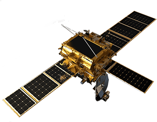
Our service gives you on-demand access to our state-of-the-art technology, making it an affordable and convenient solution for mining and archaeological professionals. Our advanced LIDAR technology captures high-resolution 3D images of the Earth's subsurface, enabling us to map various materials and structures. Plus, our satellite constellation provides global coverage, so we can meet your specific needs, no matter where your project takes you.
Our team of experts is dedicated to helping you unlock the full potential of our technology, and we are always striving to improve our services and data products. Whether you're searching for mineral deposits, investigating historical sites, or simply curious about the Earth's hidden secrets, our subscription-based service has everything you need.
Check out our Technology page to learn more about our services, including detailed information on our data products. As a bonus, we offer universities and insitutes a free educationa plans, so you can experience the power of our technology firsthand within academic settings. If you have any questions or would like to learn more about our services, don't hesitate to contact us.
With our remote sensing technology that uses laser pulses to create high-resolution 3D images of the Earth's surface. LIDAR data can be used to identify and map various surface features, including vegetation, topography, and man-made structures. In archaeology, This technology can be used to identify and map ancient settlements, fortifications, and other structures that may be difficult to see on the ground. LIDAR is particularly useful for archaeological research in dense forests, jungles, or other areas with dense vegetation or difficult terrain.
Using advanced remote sensing techniques, we can identify and map mineral deposits and water sources with high accuracy and resolution. This can be particularly useful for mining and exploration companies, as well as for agricultural and environmental applications. Our data and analysis can help organizations make informed decisions about resource management and development, improving efficiency and reducing costs in the long term.


Karahan Tepe
Turkiye
Treasure trove of archaeology
Read More
Qohaito
Eritrea
The ancient history of Eritrea
Read More
Zakhiku
Kurdistan
The Mittani Empire scale of power
Read More
PARTNERS
The Mysteria team has established collaborations with various archeological and geological institutes and international bodies to expand its research and development capabilities. Through these partnerships, the team has gained access to a broad range of expertise and resources in fields such as archaeology, geology, and remote sensing. By working closely with these institutions and organizations, Mysteria has been able to develop innovative solutions for underground penetration, geological and topological mapping, and archaeological site discovery. These collaborations have also helped to foster greater awareness and understanding of the potential applications of advanced technology in various fields, driving new research and development initiatives.
European Union Satellite Centre
MYSTERIA © 2018 - 2023 ALL RIGHTS RESERVED